Test

Certified B Corporation — Adaptive Retrofit — Humanising Infrastructure — Making better places — Architecture — Public Realm — Spatial Strategy — Creative Reuse — Urban Transformation — Decarbonisation —

Oxford-Milton Keynes-Cambridge Corridor— Study

Client(s)

National Infrastructure Commission

Collaborator(s)

SQW

5th Studio were appointed by the National Infrastructure Commission to make recommendations on the built environment of the Oxford-Milton Keynes-Cambridge Corridor. Our involvement with the NIC, Department for Transport & Treasury has been highly regarded and promises to be influential in shaping future policy.

The Oxford-Milton Keynes-Cambridge corridor encompasses a line of towns and cities some 50 miles out from London, each with an unusually productive economy. Competing on a global stage, the knowledge-driven economy of this collection of cities is impressive, but its future economic health is threatened by a lack of suitable housing and the appropriate connective infrastructure to support ‘good growth’.

Our final report produced to inform the work of the National Infrastructure Commissions is available to download here.

The project includes mapping historic growth and urbanisation across the area

The congestion caused by commuting threatens the environment and productivity of these communities, particularly Oxford and Cambridge. Housing delivery has been delegated to the market, which left to its own devices is failing to provide adequate numbers, and is also making poor use of finite resources.

5th Studio’s study implicitly explores the potential that could emerge from making the corridor more functional, linking existing economic clusters in a way that creates more than the sum of its parts, while accommodating anticipated growth for the next 30 years.

The study has involved multiple strands of work including; analysis of the area through mapping; developing a thorough understanding of the wider regional context; and a review of best-practice examples of innovation districts around the world, and how they are changing. The report makes recommendations for a spatial framework, safeguarding and reinforcing the vitality of this arc of high productivity locations.

"...their creative analysis of space, and understanding of place, has exceeded expectations... Their outputs are proven to be both visually appealing, and capable of bringing abstract spatial concepts and relationships ‘to life’ for analysts and decision-makers. 5th Studio’s work has been vital in securing the confidence of senior stakeholders and in communicating analyses and conclusions to a generalist audience."

The National Infrastructure Commission describing our work

The Cambridge-Milton Keynes-Oxford corridor in the context of a range of other established growth corridors
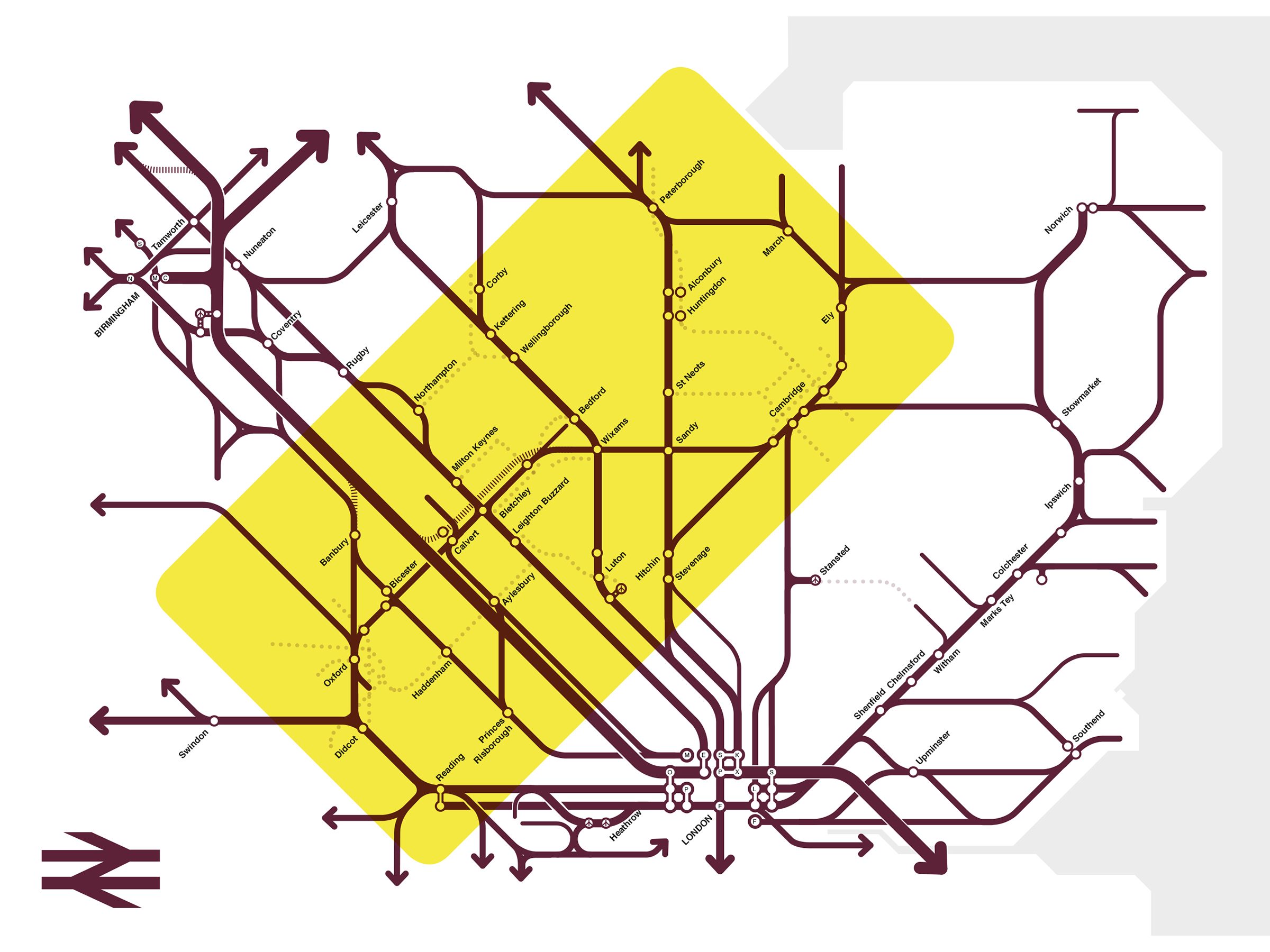
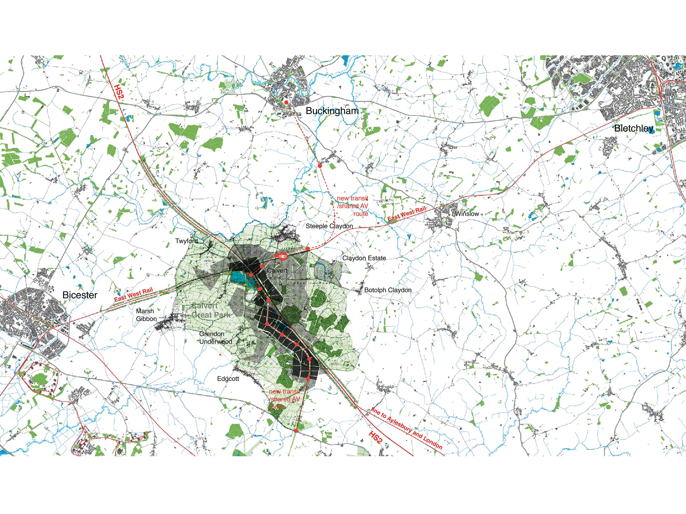
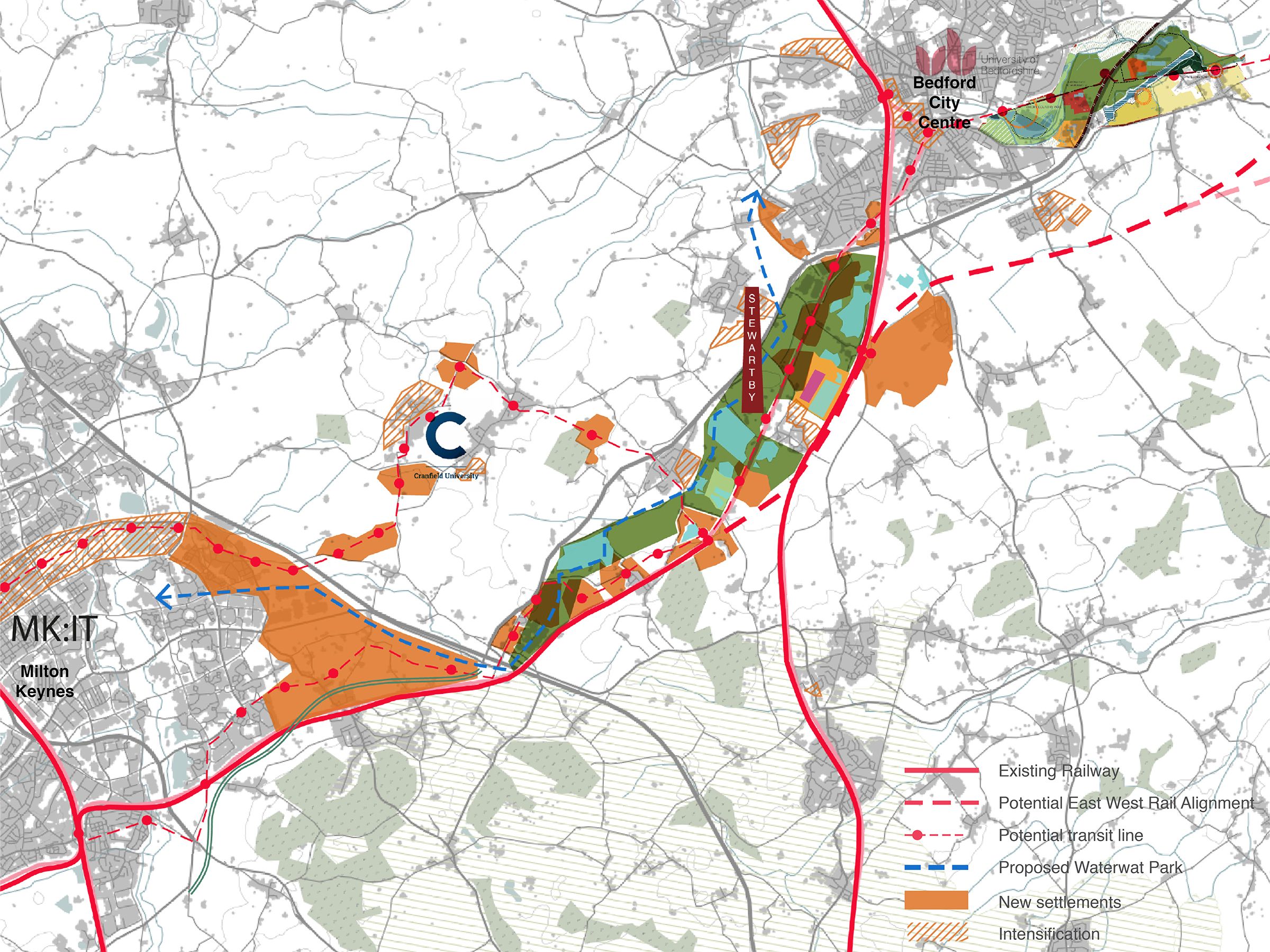
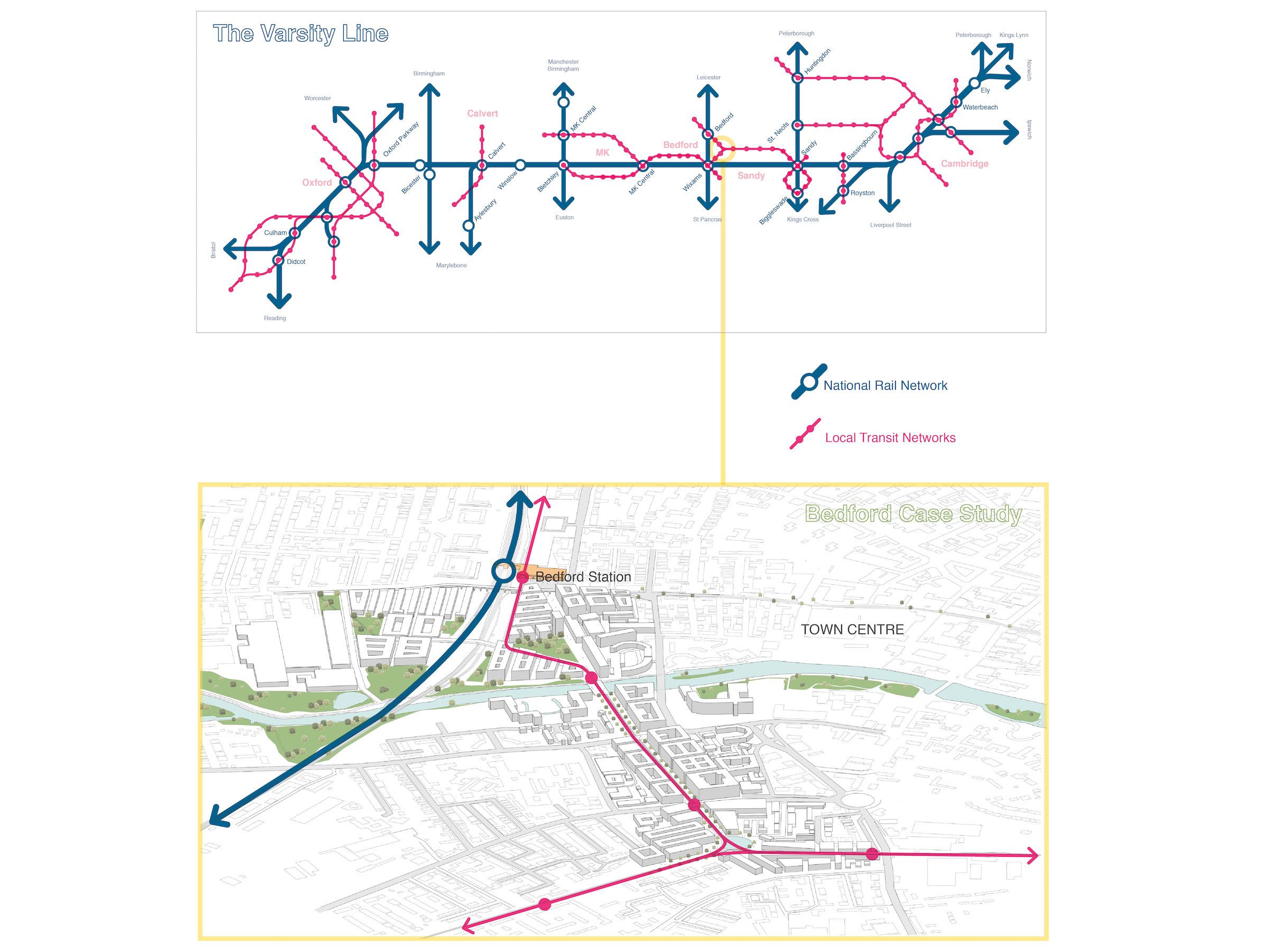
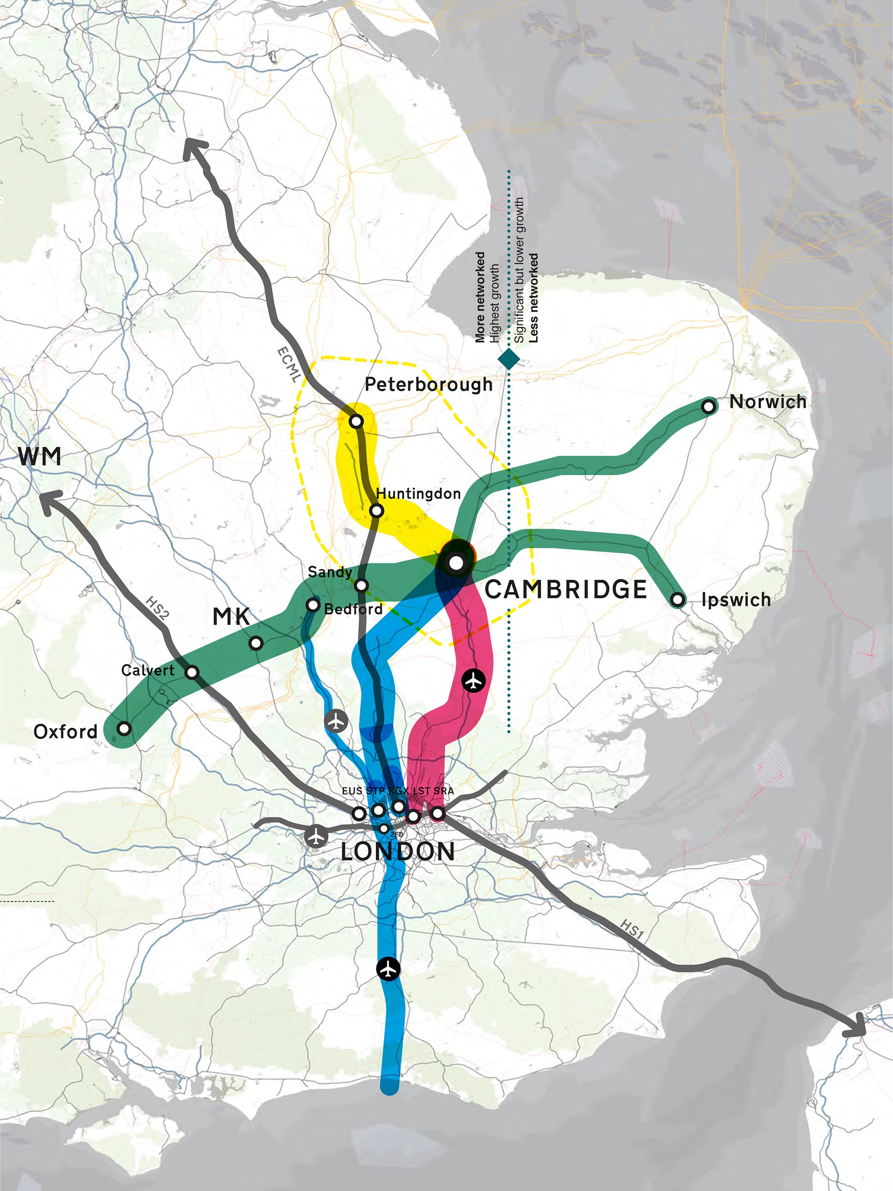
The potential future rail network, after the completion of East West Rail and HS2 - core study area highlighted

The work of 5th studio was instrumental in framing the ambition of the NIC final report on Cambridge Milton Keynes Oxford arc. Their work is rigorous, thoughtful and credible and they have been a pleasure to work with.

Prof. Sadie Morgan Client Commissioner, National Infrastructure Commission

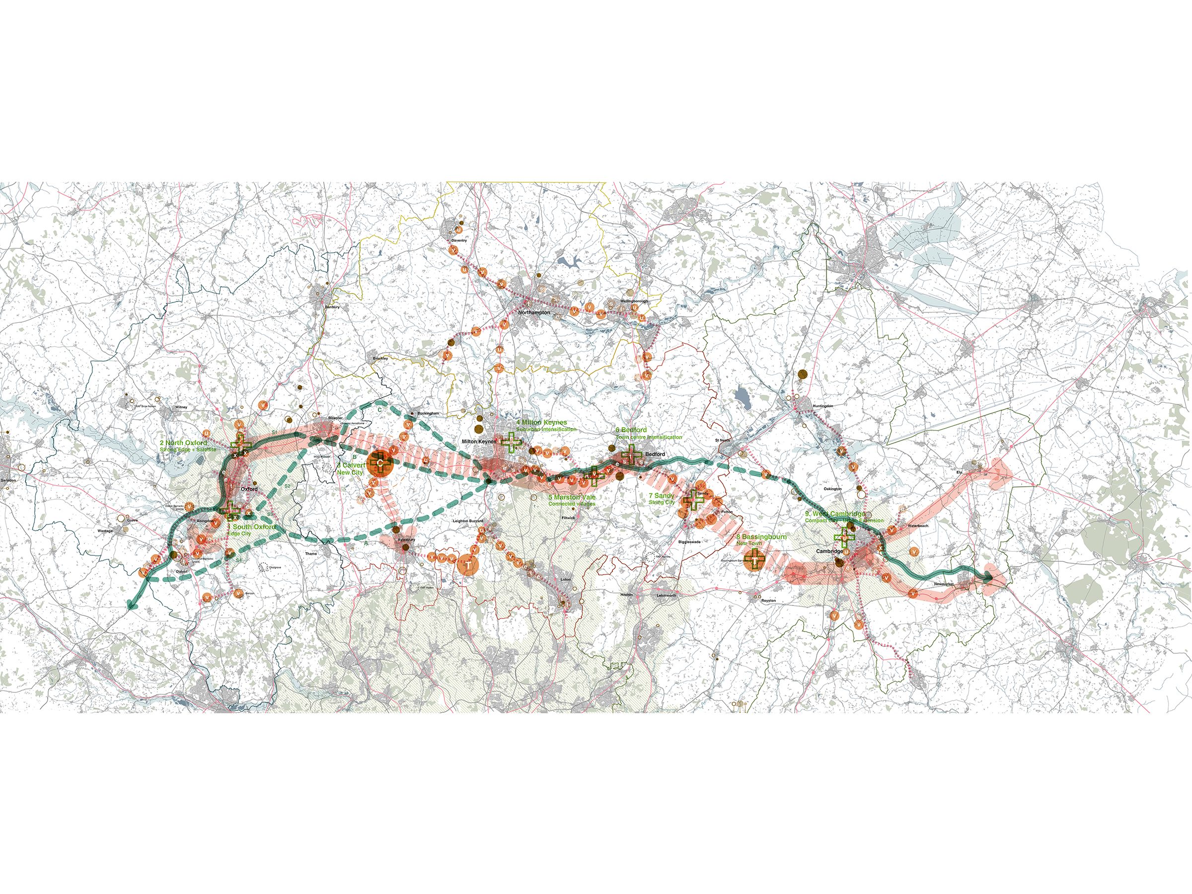
On completion of the typologies study a hypothetical scenario was developed, illustrating various development types deployed across the region, with the target of accommodating an additional 1.9 million people by 2050
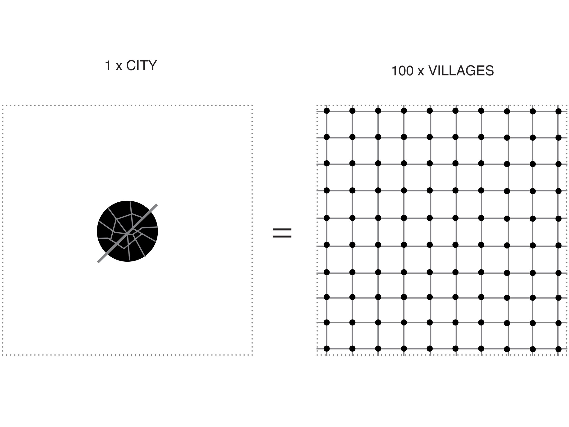
Diagram expressing the contrasting approaches to the deployment of settlements and their supporting infrastructure (the area of black is the same in both diagrams)
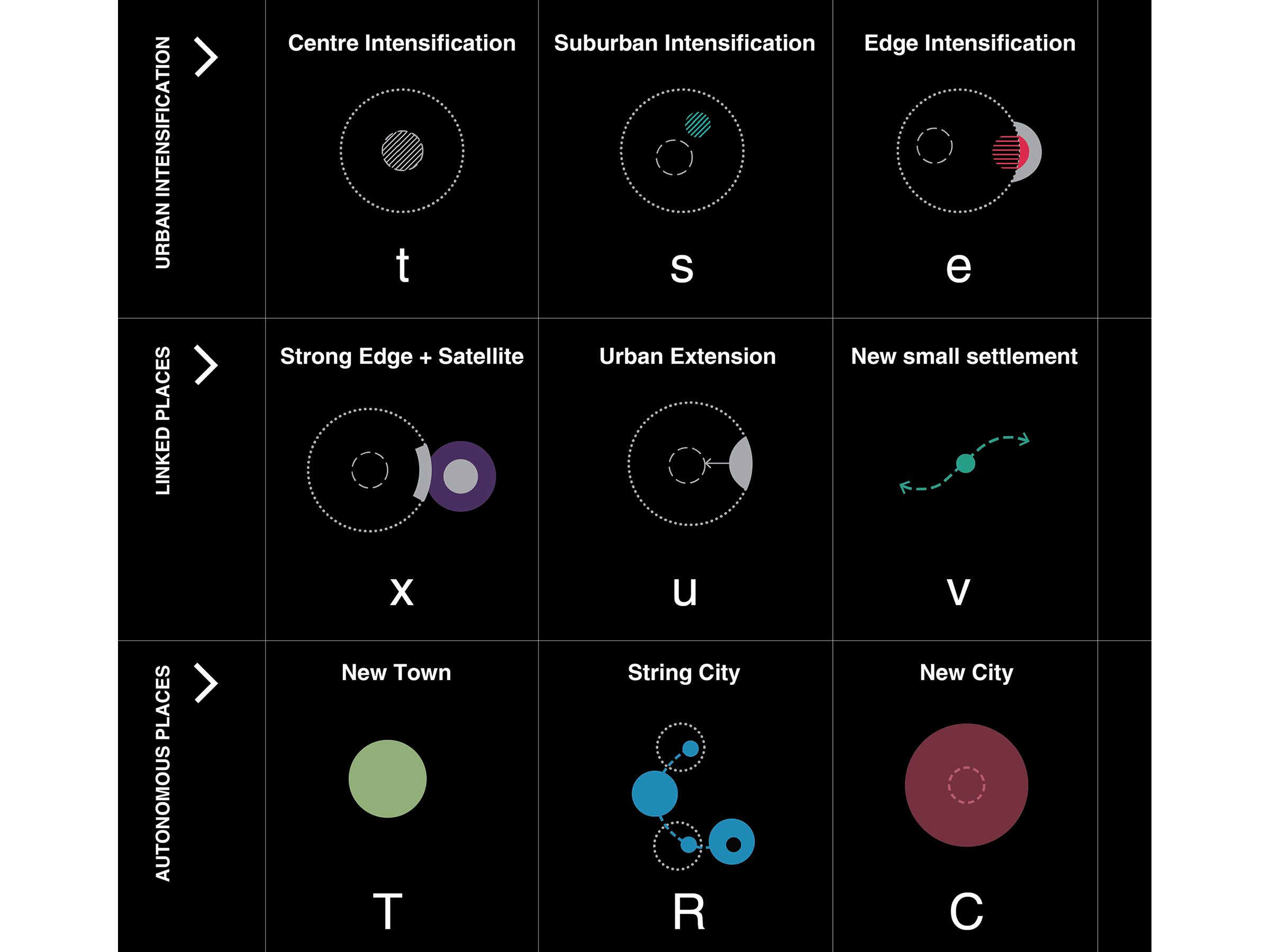
The study explores nine different settlement typologies through analysis of nine real-world case study locations
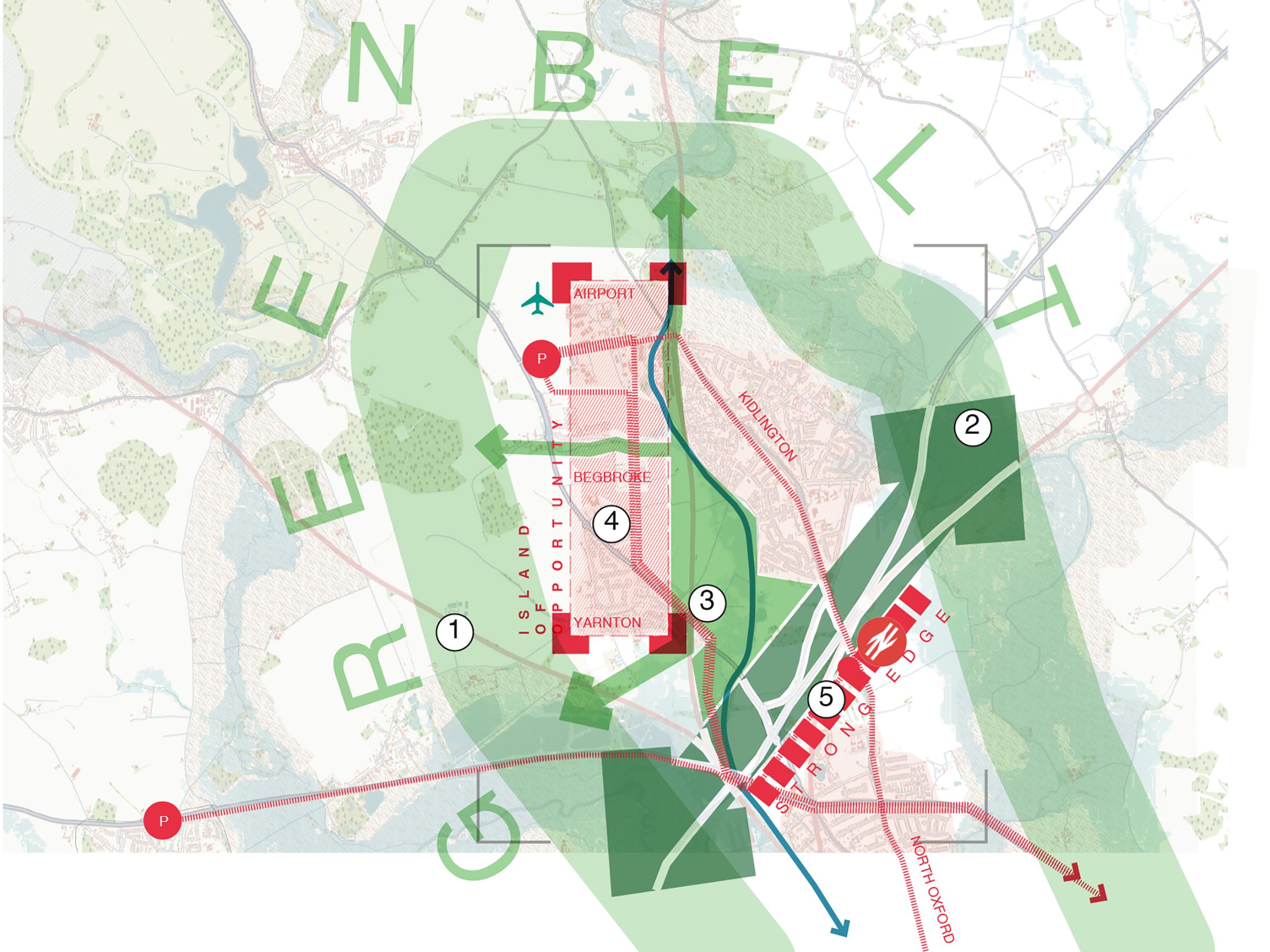
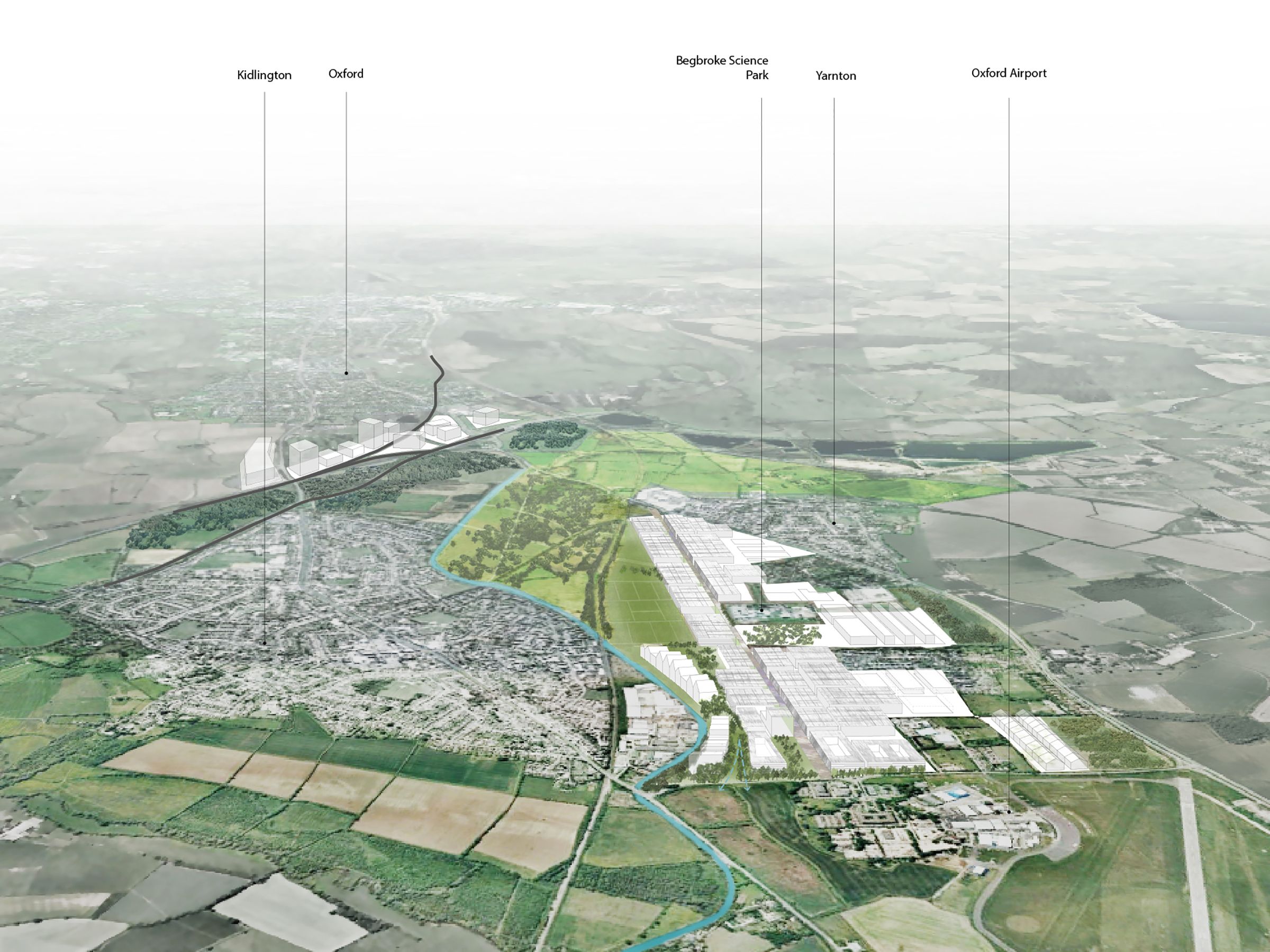
Case study exploring the ‘Strong Edge and Satellite’ typology through the development of a spatial framework for growth to the north of Oxford
1 / 0

CONTACT

studio@5thstudio.co.uk

We are keen to receive CVs and short portfolios from Part 1 and Part 2 designers. Please contact us via recruitment@5thstudio.co.uk

We actively encourage qualified applicants from underrepresented backgrounds to apply.

LONDON Unit 14 21 Wren Street London WC1X 0HF t +44 (0)20 7837 7221 View on Google Maps

CAMBRIDGE Darkroom Gwydir Street Cambridge CB1 2LJ t +44 (0)1223 516009 View on Google Maps